Top 1200 remote sensing geographic information systems PDF Book Page 41

Image analysis, classification and change detection in remote sensing : with algorithms for Python
Canty, Morton John
·532 Pages
·2019
·33.806 MB
optical remote sensing of mesoscale thermospheric dynamics above svalbard and kiruna
264 Pages
·2016
·22.9 MB
Information technology annual report
Massachusetts. Office of Management Information Systems. Strategic Planning Bureau
·24 Pages
·1998
·1.7 MB
DTIC ADA418885: About Nonlinear Dependence of Remote Sensing and Diffuse Reflection Coefficients on Gordon's Parameter
Defense Technical Information Center
·10 Pages
·0.58 MB

Light Scattering Reviews, Vol. 6: Light Scattering and Remote Sensing of Atmosphere and Surface
Brian Barkey, Suzanne Paulson, Kuo-Nan Liou (auth.), Alexander A. Kokhanovsky (eds.)
·352 Pages
·2012
·32.71 MB

Information systems for sustainable development
Lorenz M. Hilty, Eberhard K. Seifert, Rene Treibert, Eberhard K. Seifert
·398 Pages
·2004
·4.775 MB

Accounting Information Systems
830 Pages
·2011
·7.29 MB

assessing the spatial accuracy and precision of lidar for remote sensing in agriculture
164 Pages
·2017
·9.87 MB

Accounting Information Systems, 7th Edition
James A. Hall
·830 Pages
·2010
·7.403 MB
NASA Technical Reports Server (NTRS) 20120003712: Future Opportunities and Challenges in Remote Sensing of Drought
NASA Technical Reports Server (NTRS)
·0.13 MB
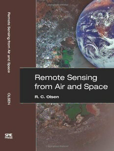
Remote Sensing from Air And Space (SPIE Press Monograph Vol. PM162)
R. C. Olsen
·262 Pages
·2007
·108.043 MB

Tactile Sensing, Information, and Feedback via Wave Propagation
Yitian Shao
·148 Pages
·2022
·5.299 MB

National Research Council Beyond Mapping: Meeting National Needs Through Enhanced Geographic Infor
National Research Council, Committee on Beyond Mapping: The Challenges of New Technologies in the Geographic Information Sciences, The Mapping Science Committee
·117 Pages
·2006
·1.56 MB

Information systems and data compression
Jerzy A. Seidler
·488 Pages
·1997
·23.552 MB

NASA Technical Reports Server (NTRS) 20120009345: Remote Sensing of Snow Cover. Section; Snow Extent
NASA Technical Reports Server (NTRS)
·0.48 MB
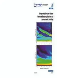
Integrated Ground-Based Remote-Sensing Stations for Atmospheric Profiling: COST Action 720: Final Report
Dirk A. M. Engelbart, Wim A. Monna, John Nash
·428 Pages
·2009
·17.43 MB

Illinois geographic information system : applications to environmental management
Krumm, Robert J
·48 Pages
·1991
·3.2 MB

DTIC ADA510417: Understanding Africa: A Geographic Approach
Defense Technical Information Center
·4.3 MB

DTIC ADA462274: Simulation & C2 Information Systems Connectivity Experiments (SINCE)
Defense Technical Information Center
·44 Pages
·4.7 MB

Putting Fear of Crime on the Map: Investigating Perceptions of Crime Using Geographic Information Systems
Bruce J. Doran, Melissa B. Burgess (auth.)
·294 Pages
·2012
·10.802 MB

