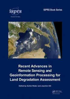
Download Recent Advances in Remote Sensing and Geoinformation Processing for Land Degradation Assessment (International Society for Photogrammetry and Remote Sensing (Isprs)) PDF Free - Full Version
Download Recent Advances in Remote Sensing and Geoinformation Processing for Land Degradation Assessment (International Society for Photogrammetry and Remote Sensing (Isprs)) by Achim Roeder, Joachim Hill in PDF format completely FREE. No registration required, no payment needed. Get instant access to this valuable resource on PDFdrive.to!
About Recent Advances in Remote Sensing and Geoinformation Processing for Land Degradation Assessment (International Society for Photogrammetry and Remote Sensing (Isprs))
Land degradation and desertification are amongst the most severe threats to human welfare and the environment, as they affect the livelihoods of some 2 billion people in the world’s drylands, and they are directly connected to pressing global environmental problems, such as the loss of biological diversity or global climate change. Strategies to combat these processes and mitigate their effects at the land-management and policy level require spatially explicit, up-to-date information, which can be provided based on remote sensing data and using geoinformation processing techniques. Recent Advances in Remote Sensing and Geoinformation Processing for Land Degradation Assessment introduces the current state of the art in this field and provides an overview of both conceptual and technological advances of the recent past. With a specific focus on desertification and land degradation, the volume covers the assessment of related biophysical indicators, as well as complementary qualitative information at different spatial and temporal scales. It is shown how remote sensing data may be utilized in the context of assessing and monitoring affected ecosystems and how this information may be assimilated into integrated interpretation and modelling concepts. In addition, different case studies are provided to demonstrate the implementation of these methods in the frame of different local settings. The volume will be of interest to scientists and students working at the interface of ecosystem services, land degradation/desertification, spatial ecology, remote sensing and spatial modelling, as well as to land managers and policy makers.
Detailed Information
| Author: | Achim Roeder, Joachim Hill |
|---|---|
| Publication Year: | 2009 |
| ISBN: | 9780415397698 |
| Pages: | 422 |
| Language: | English |
| File Size: | 12.364 |
| Format: | |
| Price: | FREE |
Safe & Secure Download - No registration required
Why Choose PDFdrive for Your Free Recent Advances in Remote Sensing and Geoinformation Processing for Land Degradation Assessment (International Society for Photogrammetry and Remote Sensing (Isprs)) Download?
- 100% Free: No hidden fees or subscriptions required for one book every day.
- No Registration: Immediate access is available without creating accounts for one book every day.
- Safe and Secure: Clean downloads without malware or viruses
- Multiple Formats: PDF, MOBI, Mpub,... optimized for all devices
- Educational Resource: Supporting knowledge sharing and learning
Frequently Asked Questions
Is it really free to download Recent Advances in Remote Sensing and Geoinformation Processing for Land Degradation Assessment (International Society for Photogrammetry and Remote Sensing (Isprs)) PDF?
Yes, on https://PDFdrive.to you can download Recent Advances in Remote Sensing and Geoinformation Processing for Land Degradation Assessment (International Society for Photogrammetry and Remote Sensing (Isprs)) by Achim Roeder, Joachim Hill completely free. We don't require any payment, subscription, or registration to access this PDF file. For 3 books every day.
How can I read Recent Advances in Remote Sensing and Geoinformation Processing for Land Degradation Assessment (International Society for Photogrammetry and Remote Sensing (Isprs)) on my mobile device?
After downloading Recent Advances in Remote Sensing and Geoinformation Processing for Land Degradation Assessment (International Society for Photogrammetry and Remote Sensing (Isprs)) PDF, you can open it with any PDF reader app on your phone or tablet. We recommend using Adobe Acrobat Reader, Apple Books, or Google Play Books for the best reading experience.
Is this the full version of Recent Advances in Remote Sensing and Geoinformation Processing for Land Degradation Assessment (International Society for Photogrammetry and Remote Sensing (Isprs))?
Yes, this is the complete PDF version of Recent Advances in Remote Sensing and Geoinformation Processing for Land Degradation Assessment (International Society for Photogrammetry and Remote Sensing (Isprs)) by Achim Roeder, Joachim Hill. You will be able to read the entire content as in the printed version without missing any pages.
Is it legal to download Recent Advances in Remote Sensing and Geoinformation Processing for Land Degradation Assessment (International Society for Photogrammetry and Remote Sensing (Isprs)) PDF for free?
https://PDFdrive.to provides links to free educational resources available online. We do not store any files on our servers. Please be aware of copyright laws in your country before downloading.
The materials shared are intended for research, educational, and personal use in accordance with fair use principles.

