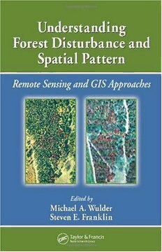
Download Understanding Forest Disturbance and Spatial Pattern: Remote Sensing and GIS Approaches PDF Free - Full Version
Download Understanding Forest Disturbance and Spatial Pattern: Remote Sensing and GIS Approaches by Michael A. Wulder, Steven E. Franklin in PDF format completely FREE. No registration required, no payment needed. Get instant access to this valuable resource on PDFdrive.to!
About Understanding Forest Disturbance and Spatial Pattern: Remote Sensing and GIS Approaches
Remote sensing and GIS are increasingly used as tools for monitoring and managing forests. Remotely sensed and GIS data are now the data sources of choice for capturing, documenting, and understanding forest disturbance and landscape pattern. Sitting astride the fields of ecology, forestry, and remote sensing/GIS, Understanding Forest Disturbance and Spatial Pattern: Remote Sensing and GIS Approaches takes you through the general biological or landscape ecological context of forest disturbance to remote sensing and GIS technological approaches and pattern description and analysis, with compelling applied examples of integration and synthesis. Written by experts, peer-reviewed to adhere to the strictest standards and highest quality criteria, these chapters discuss natural and human-caused forest change and consider factors such as biological setting, monitoring approaches, scale issues, and pattern analysis. The book explores forest disturbance and spatial pattern from an ecological point-of-view within the context of structure, function, pattern, and change. It concludes with a summary of the issues related to detection and mapping of forest disturbances with remotely sensed and GIS data. The authors elucidate how the elements presented, from ecological underpinnings, data considerations, change detection method, and pattern analysis, combine into a problem solving, information generating approach. You may find this subject covered briefly in a small sub-section in remote sensing forestry texts, or in limited technical detail in the ecology literature. The in-depth, detailed information provided in this book allows you to develop an understanding of the application of BOTH remote sensing and GIS technologies to forest change and the impacts of fire, insect infestation, forest harvesting, and other potential change influences – such as extreme weather events. This book provides guidance on how to master the challenges of capturing and characterizing forest disturbance and spatial patterns.
Detailed Information
| Author: | Michael A. Wulder, Steven E. Franklin |
|---|---|
| Publication Year: | 2006 |
| Pages: | 269 |
| Language: | English |
| File Size: | 7.413 |
| Format: | |
| Price: | FREE |
Safe & Secure Download - No registration required
Why Choose PDFdrive for Your Free Understanding Forest Disturbance and Spatial Pattern: Remote Sensing and GIS Approaches Download?
- 100% Free: No hidden fees or subscriptions required for one book every day.
- No Registration: Immediate access is available without creating accounts for one book every day.
- Safe and Secure: Clean downloads without malware or viruses
- Multiple Formats: PDF, MOBI, Mpub,... optimized for all devices
- Educational Resource: Supporting knowledge sharing and learning
Frequently Asked Questions
Is it really free to download Understanding Forest Disturbance and Spatial Pattern: Remote Sensing and GIS Approaches PDF?
Yes, on https://PDFdrive.to you can download Understanding Forest Disturbance and Spatial Pattern: Remote Sensing and GIS Approaches by Michael A. Wulder, Steven E. Franklin completely free. We don't require any payment, subscription, or registration to access this PDF file. For 3 books every day.
How can I read Understanding Forest Disturbance and Spatial Pattern: Remote Sensing and GIS Approaches on my mobile device?
After downloading Understanding Forest Disturbance and Spatial Pattern: Remote Sensing and GIS Approaches PDF, you can open it with any PDF reader app on your phone or tablet. We recommend using Adobe Acrobat Reader, Apple Books, or Google Play Books for the best reading experience.
Is this the full version of Understanding Forest Disturbance and Spatial Pattern: Remote Sensing and GIS Approaches?
Yes, this is the complete PDF version of Understanding Forest Disturbance and Spatial Pattern: Remote Sensing and GIS Approaches by Michael A. Wulder, Steven E. Franklin. You will be able to read the entire content as in the printed version without missing any pages.
Is it legal to download Understanding Forest Disturbance and Spatial Pattern: Remote Sensing and GIS Approaches PDF for free?
https://PDFdrive.to provides links to free educational resources available online. We do not store any files on our servers. Please be aware of copyright laws in your country before downloading.
The materials shared are intended for research, educational, and personal use in accordance with fair use principles.

